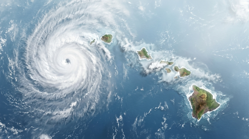
Hurricane Nolo is moving past the Hawaiian Islands, according to an update from National Hurricane Director Michael Brennan. The shift may reduce direct threats, but officials and residents must still watch for changing marine and weather conditions.
Brennan provided the latest assessment as the hurricane passed the island chain. The available update did not include Nolo’s wind speed, location, direction, or forecast track.
Those missing details limit any firm assessment of damage or remaining risks. They also make official local forecasts especially important while the storm moves away.
Passing Storms Can Leave Hazards Behind
A hurricane does not need to cross land to cause dangerous conditions. Its circulation can send large waves toward shore and produce strong currents far from its center.
Heavy rain can also affect parts of an island chain unevenly. Mountain slopes may increase rainfall in some locations, while nearby communities receive much less.
Conditions can differ sharply from one island to another. A forecast that sounds encouraging for one county may not apply elsewhere.
- Large surf can reach exposed coastlines after the storm begins moving away.
- Rip currents may threaten swimmers even under improving skies.
- Rain can trigger flooding or rockfalls in vulnerable areas.
The hurricane’s passage past Hawaii is therefore an important turn, not an automatic all-clear. Emergency guidance may remain in place until local officials confirm that specific threats have eased.
Forecast Details Will Shape the Risk
Forecasters will track whether Nolo keeps moving away from the islands or changes speed and direction. Even a modest shift can alter rainfall, wind, and surf forecasts.
Storm intensity also matters. A weakening hurricane may still generate rough seas, while a stronger system can affect a wider area without making landfall.
Brennan’s role as National Hurricane Director gives the update federal authority. Still, residents should rely on local emergency managers for evacuation orders, road closures, school changes, and shelter information.
National forecasts describe the storm’s larger movement. Local agencies translate that information into neighborhood-level decisions, where geography can make a major difference.
Hawaii Faces Distinct Hurricane Challenges
Hawaii’s location creates special planning problems during tropical cyclones. Island communities cannot depend on quick overland support from neighboring states, and ports and airports are key supply links.
Coastal development also places homes, roads, hotels, and public facilities near surf hazards. Meanwhile, steep terrain can turn intense rainfall into sudden runoff.
These factors explain why preparations often continue even when a storm is expected to miss the islands. Forecast tracks show likely movement, but they do not mark the full reach of wind, rain, or waves.
What Officials Will Watch Next
The next updates should clarify Nolo’s strength, distance from land, forward speed, and expected path. Any watches, warnings, rainfall estimates, or surf alerts will provide a clearer measure of the threat.
Residents and visitors should monitor official forecasts rather than social media claims. Beach conditions deserve special attention because hazardous surf can outlast the most visible signs of a storm.
Nolo’s movement past Hawaii offers a potentially safer trend, but the limited information supports caution. The key question is no longer only where the center travels. It is how long the hurricane’s rain, wind, and ocean effects remain near the islands.