A deadly flash flood swept through Texas Hill Country, leaving residents and visitors scrambling for safety as rising waters caught many off guard. The region, historically prone to sudden flooding, experienced a rapid rise in river levels that turned normally peaceful waterways into dangerous torrents.
The Texas Hill Country, with its scenic landscapes and popular recreational areas, sits in what meteorologists often call “Flash Flood Alley” – an area where steep terrain, thin soils, and intense rainfall create perfect conditions for rapid water rise. Despite this known risk, the recent flooding event left many people unprepared and vulnerable.
Warning System Failures
Investigators are examining why established warning systems apparently failed to alert residents in time. Early reports suggest a combination of factors may have contributed to the communication breakdown.
Local emergency management officials acknowledge that some warning sirens malfunctioned during the critical early hours of the flooding. Additionally, cell service in remote parts of the region is spotty, preventing emergency alerts from reaching everyone at risk.
“Our alert system is designed to give people adequate time to evacuate,” said a county emergency management coordinator. “We’re conducting a full review to understand why some residents report receiving no warnings whatsoever.”
Rapid Water Rise Exceeded Predictions
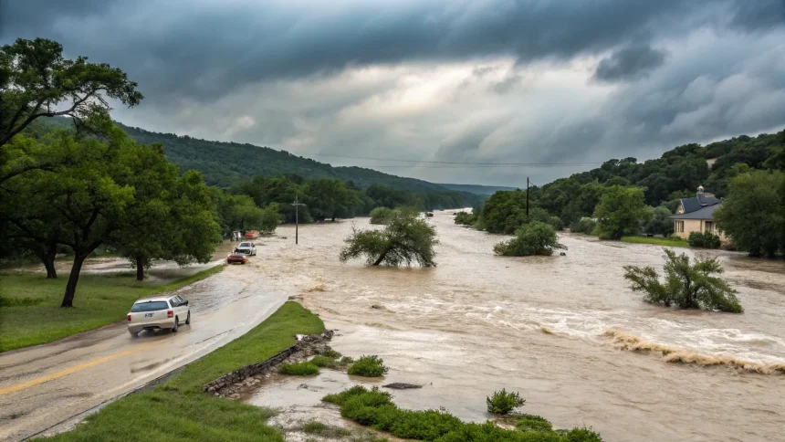
The speed at which water levels rose caught even experienced locals by surprise. Rainfall upstream accumulated faster than forecast models predicted, sending a wall of water downstream with minimal notice.
Meteorological data shows that over eight inches of rain fell in some upstream areas within a three-hour period – far exceeding the forecast of two to four inches spread over a longer timeframe. This intense rainfall, combined with already saturated ground from previous storms, created runoff conditions that overwhelmed river channels.
“I’ve lived here 30 years and never seen the water come up that fast,” said a longtime resident whose home was damaged in the flood. “Usually we have at least an hour’s warning. This time, the river rose six feet in twenty minutes.”
Tourism Factors Increased Vulnerability
The flooding coincided with a busy tourist season, placing many visitors unfamiliar with local flood risks in danger. Vacation rentals and campgrounds located in flood-prone areas were particularly hard hit.
Many tourists lacked awareness of evacuation routes and emergency procedures. Local officials are now considering stricter regulations requiring rental properties and campgrounds to provide clear flood safety information to all guests.
Three key factors made tourists especially vulnerable:
- Unfamiliarity with local terrain and flood patterns
- Limited access to local news and alert systems
- Vacation properties often located in scenic but flood-prone areas
Infrastructure Challenges
The region’s infrastructure struggled to handle the flood event. Several low-water crossings became impassable, cutting off evacuation routes. Two bridges suffered structural damage, further complicating rescue efforts.
County commissioners had previously delayed funding for flood mitigation projects, including improved drainage systems and bridge replacements. These decisions are now facing renewed scrutiny in the aftermath of the disaster.
Engineers point to outdated flood maps that haven’t been updated to reflect increased development in the watershed. New construction has reduced natural absorption areas and increased runoff volumes during heavy rain events.
As recovery efforts continue, local officials are pledging to improve warning systems and infrastructure. Meanwhile, residents and business owners face difficult decisions about rebuilding in an area where the next flash flood is not a question of if, but when.